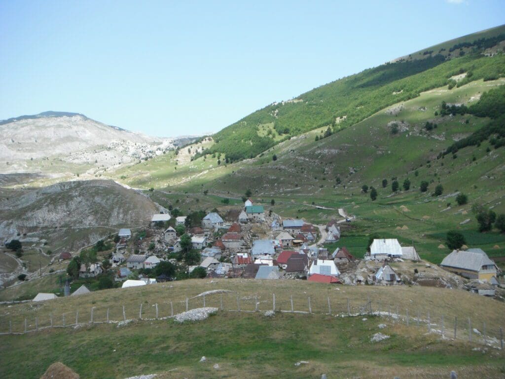
Lukomir village sits at an altitude of 1,500 metres on the Bjelašnica mountain. Our plan to today was to take the gravel tracks in the mountains to find the Bosniak village. We had no idea where we would stay that night and had no GPS to guide us.
Leaving Sarajevo
Having spent the last night in a hotel, which was fairly civilised for us, we were fully refreshed and we got cracking early after a light breakfast.
The plan for today was to find our way out of Sarajevo and head for the isolated mountain village of Lukomir, which has a population of around 13 Bosniak people on the Bjelašnica mountain. This is one of Europes last remote villages.
We were planning on having a look around the beautiful area and then later in the day we would continue and hope to either camp wild, a room, or find a campsite. We had no idea where we would land.
Getting out of Sarajevo was easier said than done. The city has a one way system, we wanted to head out of the city to the southwest.
For a start vaguely towards the airport and then end up on road 18. We only need to get out a few kilometers, to find the turn off to the roads in the mountains. But there was a surprising lack of signs indicating places/destinations and exits out of Sarajevo. You would expect for instance to see the airport sign posted or the next largest city. But there was nothing. Well nothing we could see.
Luckily the city driving is fairly easy, there is a big circular oneway system around the centre, it takes about 10 minutes to go around. The previous day we did it several times, so by now we were the experts! Once we got to the western end of the system we headed south over one of the bridges and eventually with a few missed turnings found our way out, with some amusing giggles.

Before we got too far, we needed a few supplies before we headed up to Lukomir, I was anticipating wild camping up on the mountains somewhere, as without decent scale maps or a working GPS I was a little vague on how exactly to get there or what to expect. So wanted to be prepared for whatever happens.
The best map we had was a 1:200 Bosnia and Herzegovina map, which turned out to be totally inaccurate for the dirt roads. Anyway, conveniently there was a fuel station at the hotel and also conveniently at the turning off the main road was a tiny shop. Which meant we were now ready for anything … sort of.
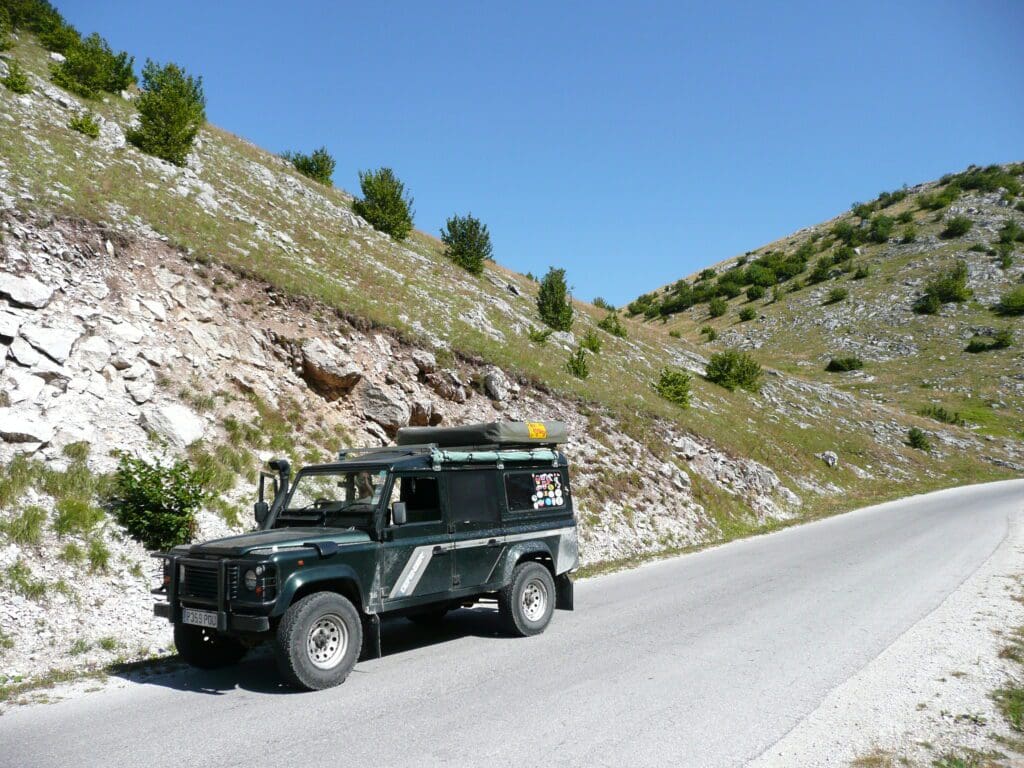
As we headed up off the main road towards Bjelašnica which is the local Ski resort, we climbed at first what seemed a fairly none descript dusty road past a load of industrial cement works (I think), beyond these as we continued up toward Bjelašnica, the road continued to become smaller and with occasionally broken tarmac. By comparison, with French and Swiss Ski resorts, Bjelašnica is tiny.

We continued to follow the signs to the most easily accessible village of Umoljani. This is reasonably well sign posted and only involves a short section of dirt track to get to the village from Bjelašnica. What we found out was that if you approach from the other side, via Ozimine, is that you can do the whole route by tarmac, on very minor roads.

Our plan was to get to Umoljani then try and find Lukomir. Which we thought would be a simple affair as the map shows a track to Lukomir and we also saw the occasional sign. But we where wrong, these just lead to Umoljani.
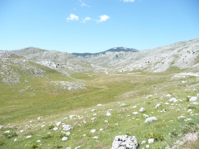
After about 40 minutes or so, we decided to just follow a track we came across in the opposite direction to which we had been indicated. I think we had given up on the idea of Lukomir and just fancied doing a bit of exploring, I could see a zig-zag track going up what I think was Vlahinja, which looked like it could also turn out to be a good stop.
However, after about 15 minutes we spotted a small sign indicating Lukomir so obediently turned as indicated by the sign.
The track seemed to go on forever. But eventually after passing a few shepards and their flocks we could see houses in the distance. Just outside the village is a tourist sign, which tells the “Story” of the village, we parked there and went for a wander.
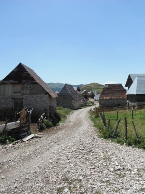
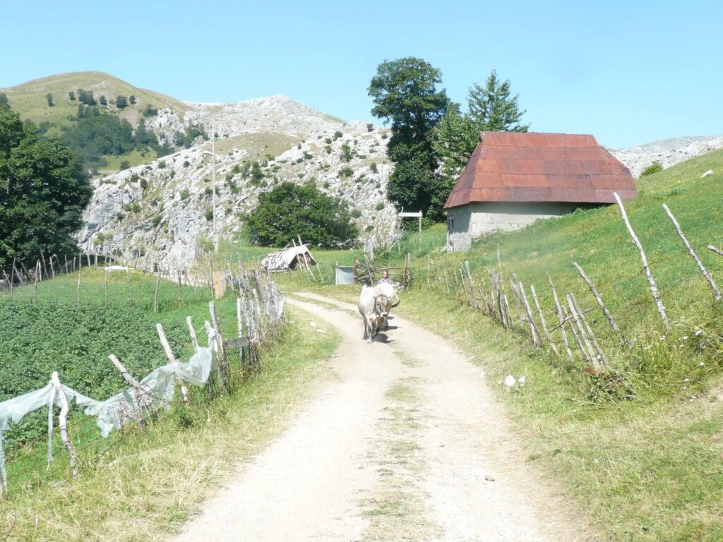
The first thing that hits you is the smell of sheep manure, there were huge piles of it, setting the odour of the area, it was not unpleasant, just strong. As we passed the first houses on the track through the village, the old ladies of the houses shouted for us to buy some of there products, which they had hanging on the fence. They seemed to mainly be slippers made of wool.
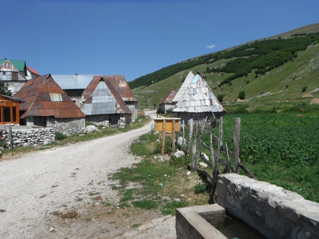
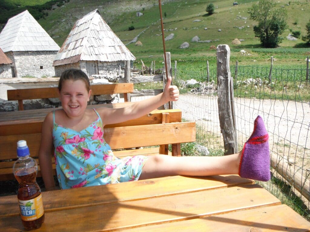
We continued to wander along the track and we got to the water spring in the centre of the village, which in the heat, offered an opportunity to cool off. Here we saw there was a small wood sign indicating food, which lead us to a few tables outside a house. We sat down and tentatively asked for drink. Cassie had juice, I cheekily asked if they had beer … I was in luck. The guy running the place stopped to have a drink too, he had been cutting wood. He was spending the summer up in the village with his mother, at his grandfather’s house. He used to be a tram driver in Sarajevo, but having spent a year training he had been waiting for two years to get a new contract. This was an opportunity for him to earn some cash for the winter, in Sarajevo. He explained that not many people spend the winter on the mountains anymore, most opt to return to Sarajevo or lower towns for the cold months. We also learnt some of the villagers stories and how sometimes too many tourists can appear. Which seemed a shame.
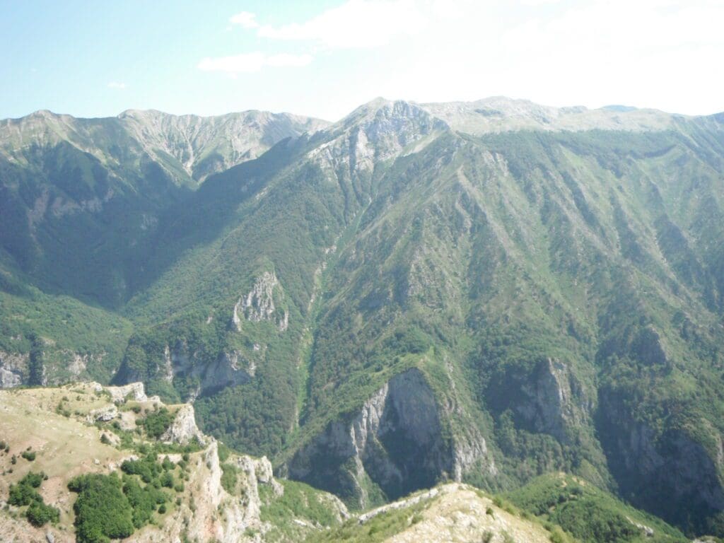
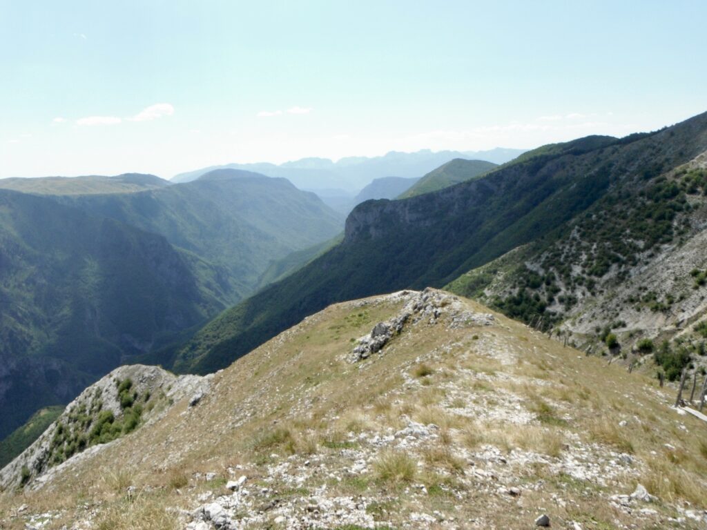
Later we purchased some slippers and grabbed some stuff out the car, so we could go for a short walk and have a picnic lunch. We found an excellent spot on a peak over looking the canyon beyond the village.
During lunch we talked about what to do next, I had asked if we could camp nearby and the guy who gave us drinks said we could camp where we parked. Wendy was not comfortable with that, feeling like we were intruding. So we drove down from the mountain tracks.
Finding our way out
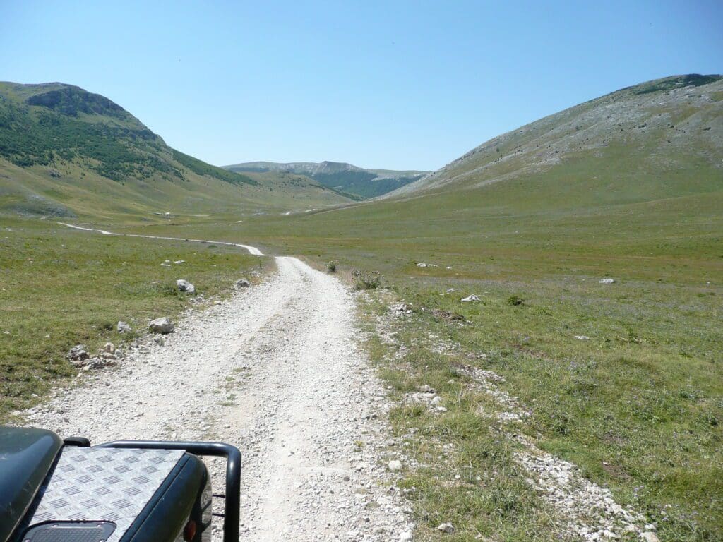
At first we headed out the way we came, but spotted a sign to Vrdolje and opted to follow that a different was down. This would we hope lead us to a main road on which lies Konjic, which we thought would have camping.
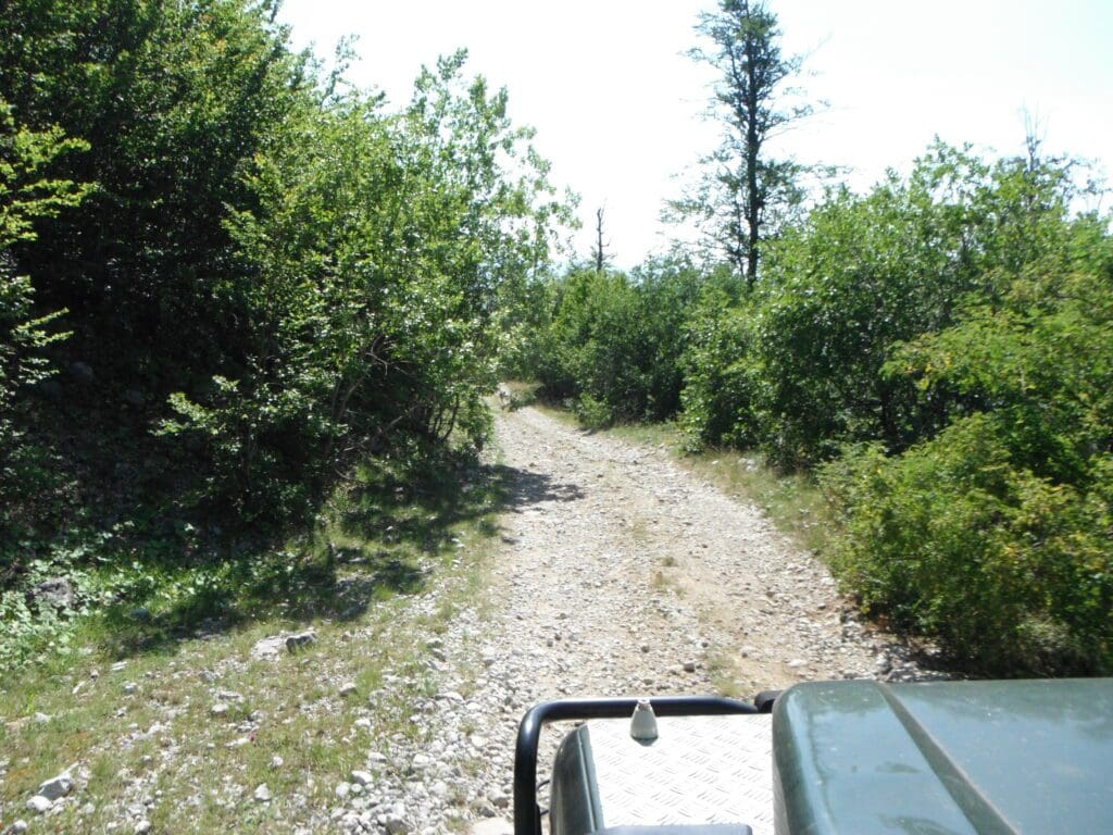
These tracks require a certain amount of faith. You’ll pass loads of branches, and with no signs, we always opted to take what we fought was the continuation of the main route. Always what plays in you mind is mines, which are normally indicated and should not be a problem in the area we were in but, it just sits there. We were lucky we passed a man and he confirmed we were headed in the right direction and that we should just continue.
Camping at Jablaničko Jezero, near Konjic
About an hour or so later we popped out on the main road, and looked for camping near Konjic. Which was fairly well sign posted. We had to pay a small 5 KM toll to take the road into the campsite, which considering it was 50m beyond the toll man was steep. We did not mind though. The campsite was basic, which we like, outdoor shower, lake to swim and a horrible toilet.
We parked, grabbed a beer from the fridge and went to cool down in the lake. Later we popped into the restaurant in the site and had Ćevapi for dinner with several beers. All of these places have restaurants and being so cheap, we have been using them rather than cooking.